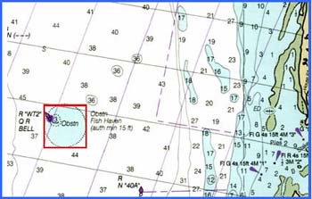

The "Cell " Reef is located west of Hungars Creek, bayside of the Eastern Shore. The site was recently enlarged to a square shape.
The subsurface remains of the Wolf Trap Degaussing Station (the "Cell"), located near the NW perimeter, is the primary structure at this site. It is marked by the USCG buoy "WT2".
One thousand tons of concrete pipe donated by Hanson Pipe Company was added to this site in 2001. In 2006, 2000 tons of concrete block, donated by Bayshore Concrete Products, Inc., was added. The deployments were funded by the Saltwater Fishing License revenue.
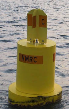
A yellow VMRC buoy designated "C" marks this fish haven.Tires in Concrete (TICs) and Tetrahedrons have also been added to the site.